|
Samuel Justus Recreational Trail |
one moment while we fetch a trail picture
|
|
|
Samuel Justus Recreational Trail |
one moment while we fetch a trail picture
|
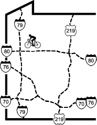
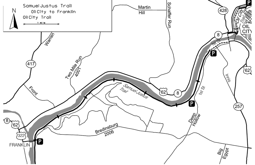
The trail is almost completely flat and runs about 30 feet above the river, affording good views of whatever is happening on the river. Birds and wildflowers are abundant. Several picnic tables, benches and historical markers provide excuses to stop and enjoy the views. There are three sets of mileage makers. One set measures mileage from the gate in Oil City, the second set measures mileage from the gate in Franklin, and the third set counts railroad miles, which start in Freeport at MP0.0 and end in Oil City at MP130. At any point on the trail the mileage from the Oil City gate plus the railroad mileage will always equal 129.2. At any point on the trail the mileage from the Oil City gate plus the mileage from the Franklin gate will always equal 5.6. This write-up uses the railroad mileages which are consistent with the mileposts on the trails to the south.
| Location | Franklin to Oil City, Venango County | ||
| Trailheads | Franklin, Oil City Wastewater Treatment Plant | ||
| Length, Surface | 5.6 miles paved with parallel gravel road | ||
| Character | Uncrowded, rural, mostly sunny, flat | ||
| Usage restrictions | Horses okay, no motorized vehicles | ||
| Amenities | Rest rooms, bike rental, food, fishing | ||
| Driving time from Pittsburgh | 1 hours 30 minutes |
Just before the gate (MP129.1) at the end of the of the sewer plant parking lot, there is a compact exercise course beside the trail. This course might be unpleasant to use if the wind is coming from the wrong direction (from the sewer plant).
At MP128.5 a large field with picnic tables lies between the trail and the river. Between MP126.7 and MP125.2 at least half a dozen oil pumps, some still operating, and several storage tanks are visible from the trail. Several are close enough to the trail that they can be inspected without encroaching on private land.
The most prominent feature of this trail is River Ridge Farm at MP124.5. This impressive mansion was built in 1913 by Joseph C. Sibley, who developed a formula for refining crude oil for use in railroad engines (Galena Oil) and later served five terms in the US House of Representatives. The estate originally included 21 other buildings, including a stone campanile near the river. This bell tower still stands, but the eleven bells have been removed. The entrance gate, with “River Ridge Farm” carved across the top, still stands near where a railroad siding served the estate. The estate is now (2018) partly farmland and posted against entry.
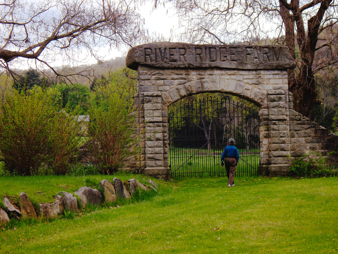
Entry gate for River Ridge Farm
At MP124.4 power lines join the trail from across the river and follow it to the trailhead and beyond. The Franklin gate is at MP123.4. A short distance later a former bike shop is on the left and then the trail descends 10 feet to pass under the 8th St/US322 bridge. The sight lines here leave something to be desired, so caution is advised. After a short climb, the trail enters the trailhead parking lot. This lot is the trailhead for both this trail and the Allegheny River Trail (page NE-91) to the south. At the north end of the parking lot, an information center occupies the saltbox house.
Samuel Justus Recreational Trail - Oldest segment segment check 2024-Aug This page brought to you by the book